
One of our new-found friends left us a gift of a bundle of
wood outside this morning before they left.
How sweet.
We looked forward to
another non-stressful driving day exploring the north-east coast.
Heading towards the easternmost point in the
USA, West (bizarrely) Quoddy Head, we reviewed the other extremities we have reached during
this trip. Accepting that we weren’t going to get to Hawaii and Alaska, of the
48 land-locked states we definitely got as far south-east as possible on the
mainland at the tip of Florida, San Diego was as near as we wanted to get to
Mexico in the south-west and our first foray across the border into Canada was
at the most north-westerly point possible.
So, in essence, today we were striving to achieve the ‘four corners’ of
the United States.
 |
| Crossing the foggy causeway to West Quoddy Head |


Fog looked as though
it was trying to thwart us by blocking our view as we crossed the causeway
towards Quoddy Head (above), but once we’d arrived and visited the small museum
inside West Quoddy lighthouse, the sun gradually burnt off the mist:
 |
| West Quoddy lighthouse overlooking the Atlantic Ocean |
|

There was a short trail up to the highest point on the headland to get better
views of the Atlantic Ocean and the mist rolling away from the trees and rocks
added a sense of drama to the occasion. I managed to spot a couple of sealions
in the water as an extra treat and Simon and I both braved it out onto the
rocks to improve our view.
We stuck to route 1 as much as possible as we continued down
the east coast of Maine towards Acadia National Park – a location I have had circled
on our atlas since way back as a ‘must-stop’ location for wildlife and
scenery.
When I discovered on Monday
that all of the park’s three campsites are fully booked until August I was
relieved to secure a booking at another PA site, not inside the park but still
on the same island – Mount Desert Island – and at a reduced rate.
Here is where all of the history we have been
learning about for the last few days came full circle!
Mount Desert Island was first mapped and named by Pierre Dugua, who we
learnt yesterday was the leader at St Croix Island and who we also saw
commemorated in statue form in Quebec on Saturday (below) – what a guy! (a Red
Dwarf-based reference for you there…. )
 |
| The Pierre Dugua memorial at the Citadel in Quebec City |
 |
| What's that at the end of the rainbow? A Walmart, of course, a literal pot of gold! |
Having driven through some heavy rainstorms and dark skies
(above) we arrived just after 5pm and set up on a cracking hill-top
pitch with splendid views over the trees and water.
Our timing is also great as they started
running the free seasonal bus routes all around the island only five days
ago.
So, it looks like tomorrow we can
leave the RV set up and be driven around the national park to our hearts’
content.
 |
| Spot the Harvey lookalike... a popular RV make. |
I went for my usual recce, finding the swimming pool a misty
brown colour complete with floating detritus…. A swim being out of the
question, I opted for a walk instead and found myself completely alone by the
water’s edge as the tide receded.
I sat
on some rocks, transfixed, watching the seagulls and sea life in the mud that
emerged all around me. This video should hopefully show the shellfish squirting water at low tide...
 |
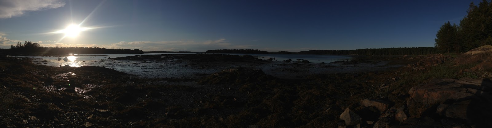
| Trying out a panoramic pic for a change.... |
I tore myself away to head back to the RV and
persuaded Simon to head back out with me to enjoy the views during sunset.
 |
| That day's arrived then.... we'll live on Ocean Drive |
 One of our new-found friends left us a gift of a bundle of
wood outside this morning before they left.
How sweet. We looked forward to
another non-stressful driving day exploring the north-east coast. Heading towards the easternmost point in the
USA, West (bizarrely) Quoddy Head, we reviewed the other extremities we have reached during
this trip. Accepting that we weren’t going to get to Hawaii and Alaska, of the
48 land-locked states we definitely got as far south-east as possible on the
mainland at the tip of Florida, San Diego was as near as we wanted to get to
Mexico in the south-west and our first foray across the border into Canada was
at the most north-westerly point possible.
So, in essence, today we were striving to achieve the ‘four corners’ of
the United States.
One of our new-found friends left us a gift of a bundle of
wood outside this morning before they left.
How sweet. We looked forward to
another non-stressful driving day exploring the north-east coast. Heading towards the easternmost point in the
USA, West (bizarrely) Quoddy Head, we reviewed the other extremities we have reached during
this trip. Accepting that we weren’t going to get to Hawaii and Alaska, of the
48 land-locked states we definitely got as far south-east as possible on the
mainland at the tip of Florida, San Diego was as near as we wanted to get to
Mexico in the south-west and our first foray across the border into Canada was
at the most north-westerly point possible.
So, in essence, today we were striving to achieve the ‘four corners’ of
the United States. 

 Fog looked as though
it was trying to thwart us by blocking our view as we crossed the causeway
towards Quoddy Head (above), but once we’d arrived and visited the small museum
inside West Quoddy lighthouse, the sun gradually burnt off the mist:
Fog looked as though
it was trying to thwart us by blocking our view as we crossed the causeway
towards Quoddy Head (above), but once we’d arrived and visited the small museum
inside West Quoddy lighthouse, the sun gradually burnt off the mist: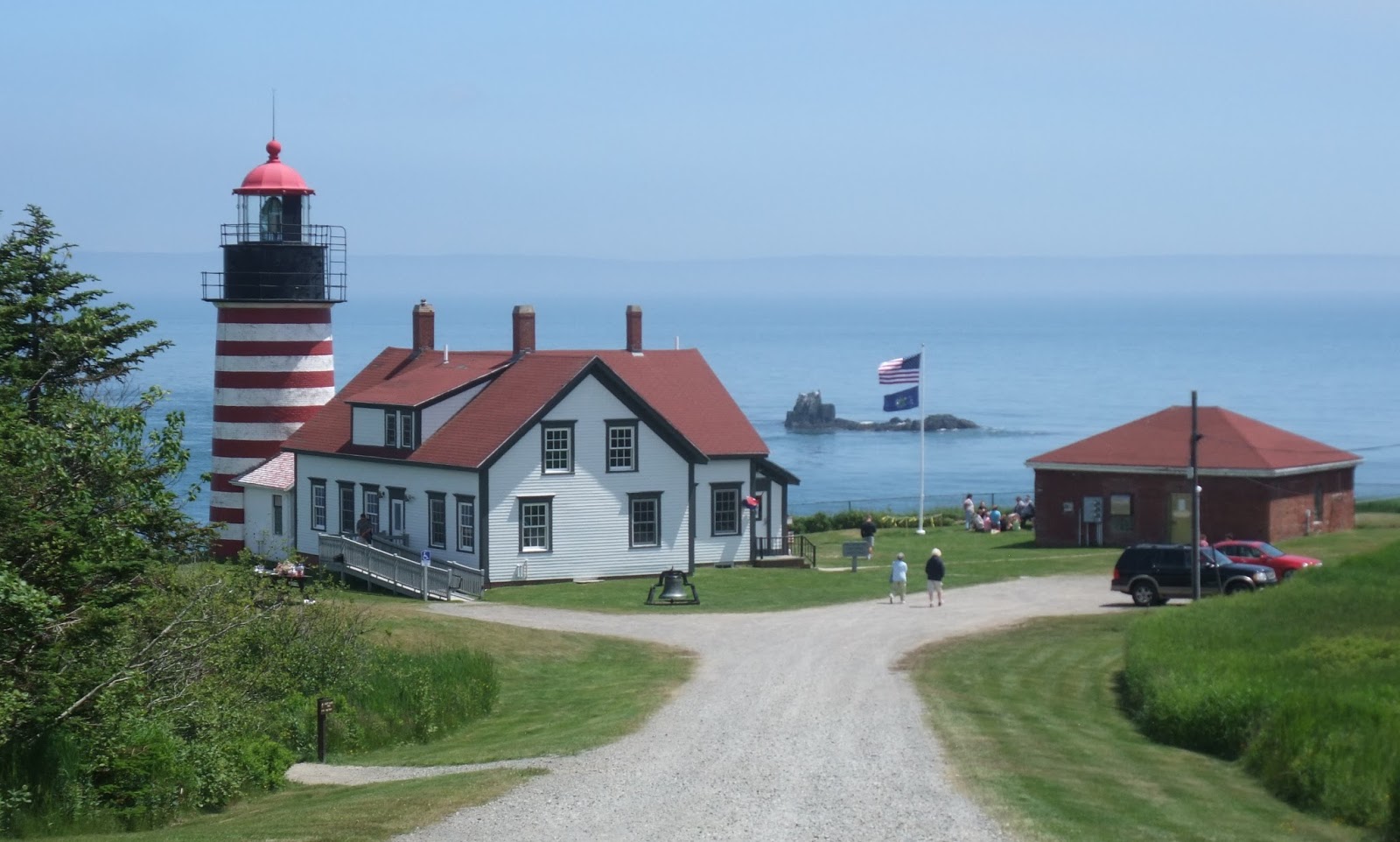
 There was a short trail up to the highest point on the headland to get better
views of the Atlantic Ocean and the mist rolling away from the trees and rocks
added a sense of drama to the occasion. I managed to spot a couple of sealions
in the water as an extra treat and Simon and I both braved it out onto the
rocks to improve our view.
There was a short trail up to the highest point on the headland to get better
views of the Atlantic Ocean and the mist rolling away from the trees and rocks
added a sense of drama to the occasion. I managed to spot a couple of sealions
in the water as an extra treat and Simon and I both braved it out onto the
rocks to improve our view.


No comments:
Post a Comment